Smugglers, The Dock, Robin Hood's Bay
Introduction
The photograph on this page of Smugglers, The Dock, Robin Hood's Bay by Jo and Steve Turner as part of the Geograph project.
The Geograph project started in 2005 with the aim of publishing, organising and preserving representative images for every square kilometre of Great Britain, Ireland and the Isle of Man.

There are currently over 7.5m images from over 14,400 individuals and you can help contribute to the project by visiting https://www.geograph.org.uk
Smugglers, The Dock, Robin Hood's Bay
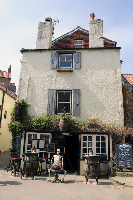
Image: © Jo and Steve Turner Taken: 29 May 2021
Grade II Listed late 18th century house listed as Bligh's Restaurant and formerly listed as Nansen House. In September 2020 The Scarborough News promoting Smugglers sale claimed it to have been built in the 1600s as stated in the sales particulars. The building sits on Marner Beck culvert to Kings Beck Culvert and was the location of a fish house at one time.
Images are licensed for reuse under creativecommons.org/licenses/by-sa/2.0
Image Location
Latitude
54.430335
Longitude
-0.532753