Thornfields
Introduction
The photograph on this page of Thornfields by Dan as part of the Geograph project.
The Geograph project started in 2005 with the aim of publishing, organising and preserving representative images for every square kilometre of Great Britain, Ireland and the Isle of Man.

There are currently over 7.5m images from over 14,400 individuals and you can help contribute to the project by visiting https://www.geograph.org.uk
Thornfields
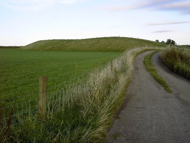
Image: © Dan Taken: 30 Sep 2005
The complex patterns of contours that dominate the surrounding area almost completely avoid this part of the grid square and on OS maps it looks like it hasn't been drawn properly. In fact this area (marked on 1:25000 maps as Disused Workings) appears to have been totally flattened for its sand and gravel. Now grassed over with only half a hill left to shelter Thornfields farm it looks very odd!
Images are licensed for reuse under creativecommons.org/licenses/by-sa/2.0
Image Location
Latitude
53.58198
Longitude
-2.163088