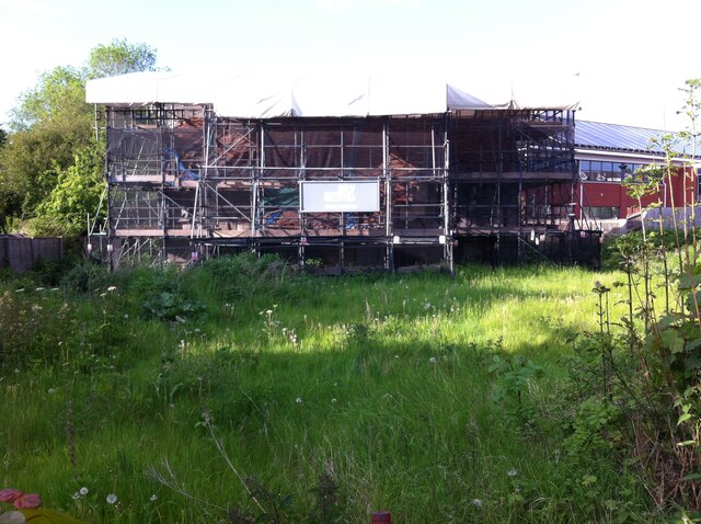
Ruined building known as the Master's House, on site of medieval St. Michael's Leper Hospital in Saltisford
Introduction
The photograph on this page of Ruined building known as the Master's House, on site of medieval St. Michael's Leper Hospital in Saltisford by A J Paxton as part of the Geograph project.
The Geograph project started in 2005 with the aim of publishing, organising and preserving representative images for every square kilometre of Great Britain, Ireland and the Isle of Man.
There are currently over 7.5m images from over 14,400 individuals and you can help contribute to the project by visiting https://www.geograph.org.uk

Image: © A J Paxton Taken: 29 May 2021
Known as the Master's House, this timber-framed building from the late 15th or early 16th century has for decades been in a ruined state. It is a listed building on the site of a scheduled ancient monument, St. Michael's Leper Hospital. The church of St. Michael was founded in 1135 and the hospital first appears in the records in 1275. Medieval leper hospitals were intended to segregate the sufferers from society, hence its location on the outskirts of Warwick. Most were suppressed at the Reformation along with monasteries (1536-40) and chantry chapels (1547), which supported them, and St Michael's hospital is described as being 'much in ruin' in 1540. It was subsequently leased to a layman, who offered alms and lodging to poor people, and the chapel and master's house, the surviving parts of the complex, were later used as cottages. https://historicengland.org.uk/listing/the-list/list-entry/1011035 Warwick District Council served a compulsory purchase order on the site in January 2021. https://www.warwickcourier.co.uk/news/people/council-serves-compulsory-purchase-order-warwicks-medieval-leper-hospital-3101841

