The Shakkin' Briggie, aka Morrison's Bridge.
Introduction
The photograph on this page of The Shakkin' Briggie, aka Morrison's Bridge. by Peter Ward as part of the Geograph project.
The Geograph project started in 2005 with the aim of publishing, organising and preserving representative images for every square kilometre of Great Britain, Ireland and the Isle of Man.

There are currently over 7.5m images from over 14,400 individuals and you can help contribute to the project by visiting https://www.geograph.org.uk
The Shakkin' Briggie, aka Morrison's Bridge.
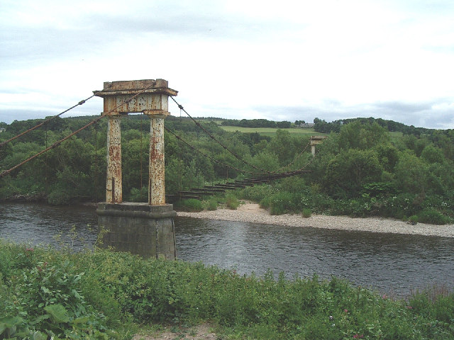
Image: © Peter Ward Taken: Unknown
Built by the Minister of St. Devenick's Kirk on the S. side of the Dee to allow worshippers to get from Cults on the N. side of the river. Now in disrepair and impassable.
Images are licensed for reuse under creativecommons.org/licenses/by-sa/2.0
Image Location


Leaflet Map data © OpenStreetMap
Latitude
57.114231
Longitude
-2.171704