Wesley House, Chapel Lane, Alnwick
Introduction
The photograph on this page of Wesley House, Chapel Lane, Alnwick by Geoff Holland as part of the Geograph project.
The Geograph project started in 2005 with the aim of publishing, organising and preserving representative images for every square kilometre of Great Britain, Ireland and the Isle of Man.

There are currently over 7.5m images from over 14,400 individuals and you can help contribute to the project by visiting https://www.geograph.org.uk
Wesley House, Chapel Lane, Alnwick
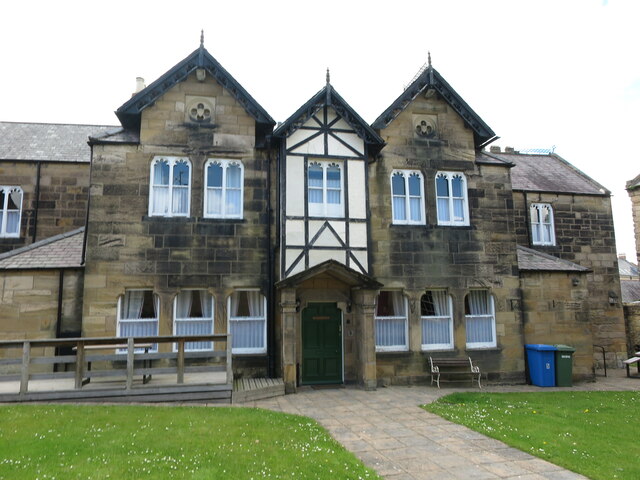
Image: © Geoff Holland Taken: 24 May 2021
The founder of the Methodist movement, John Wesley, laid the first stone of Wesley House, and its adjoining chapel https://www.geograph.org.uk/photo/6847848, in 1786. A century later it was extensively remodelled and extended by the acclaimed local-based architect Frederick Richard Wilson, at that time Diocesan Surveyor for Lindisfarne, to create this rather imposing building. These days, the building offers self-catering holiday accommodation.
Images are licensed for reuse under creativecommons.org/licenses/by-sa/2.0
Image Location


Leaflet Map data © OpenStreetMap
Latitude
55.411928
Longitude
-1.708406