You say Holbrooks I say Holbrook
Introduction
The photograph on this page of You say Holbrooks I say Holbrook by A J Paxton as part of the Geograph project.
The Geograph project started in 2005 with the aim of publishing, organising and preserving representative images for every square kilometre of Great Britain, Ireland and the Isle of Man.

There are currently over 7.5m images from over 14,400 individuals and you can help contribute to the project by visiting https://www.geograph.org.uk
You say Holbrooks I say Holbrook
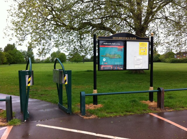
Image: © A J Paxton Taken: 21 May 2021
Holbrooks Park according to the council sign, Holbrook Park according to the Coventry city council website (though the web address contains Holbrooks). https://www.coventry.gov.uk/holbrookspark The district is named Holbrooks, the main street Holbrook Lane. The park is much longer than it is wide, with a front section by the road with more trees, a play area, a skateboard park and a drive and car park. The rear section, to which this is the entrance, has football pitches and a path that leads to Beake Avenue. On a wet and windy Friday morning in May the park was empty apart from a couple of people walking dogs.
Images are licensed for reuse under creativecommons.org/licenses/by-sa/2.0
Image Location
Latitude
52.438568
Longitude
-1.51275