Looking south-east from Jubilee Gardens, 1989
Introduction
The photograph on this page of Looking south-east from Jubilee Gardens, 1989 by Christopher Hilton as part of the Geograph project.
The Geograph project started in 2005 with the aim of publishing, organising and preserving representative images for every square kilometre of Great Britain, Ireland and the Isle of Man.

There are currently over 7.5m images from over 14,400 individuals and you can help contribute to the project by visiting https://www.geograph.org.uk
Looking south-east from Jubilee Gardens, 1989
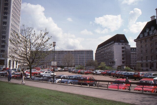
Image: © Christopher Hilton Taken: 13 Apr 1989
The buildings closing off the view are, from left: the Shell Centre; Elizabeth House, at that time home to the Department of Education and Science; County Hall North Block; and County Hall itself. The architect of Elizabeth House was the notorious John Poulson (1910-1993), better known for weaving a web of corruption in local government (https://en.wikipedia.org/wiki/John_Poulson ). The vista here is now completely blocked by new development.
Images are licensed for reuse under creativecommons.org/licenses/by-sa/2.0
Image Location


Leaflet Map data © OpenStreetMap
Latitude
51.503005
Longitude
-0.1173