Llandawke Church
Introduction
The photograph on this page of Llandawke Church by Humphrey Bolton as part of the Geograph project.
The Geograph project started in 2005 with the aim of publishing, organising and preserving representative images for every square kilometre of Great Britain, Ireland and the Isle of Man.

There are currently over 7.5m images from over 14,400 individuals and you can help contribute to the project by visiting https://www.geograph.org.uk
Llandawke Church
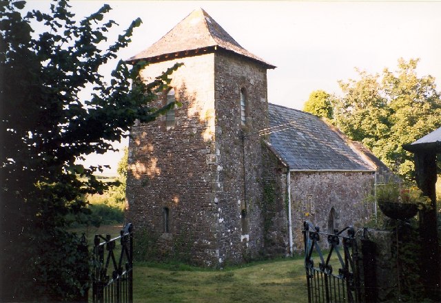
Image: © Humphrey Bolton Taken: Unknown
St Odoceus (or St Margaret Marloes?) is a very primitive 13C church (disused), on its own in a secluded valley. It was possibly founded in the dark Ages as it has a 5-6C stone with inscriptions in Ogham and Latin. It also has a 14C effigy of a woman, possibly Margaret, sister of Guy de Brian of Laugharne.
Images are licensed for reuse under creativecommons.org/licenses/by-sa/2.0
Image Location


Leaflet Map data © OpenStreetMap
Latitude
51.772168
Longitude
-4.489972