
Blythe Bridge Station
Introduction
The photograph on this page of Blythe Bridge Station by Stephen McKay as part of the Geograph project.
The Geograph project started in 2005 with the aim of publishing, organising and preserving representative images for every square kilometre of Great Britain, Ireland and the Isle of Man.

There are currently over 7.5m images from over 14,400 individuals and you can help contribute to the project by visiting https://www.geograph.org.uk
Blythe Bridge Station
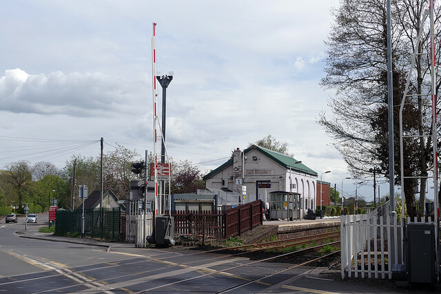
Image: © Stephen McKay Taken: 13 May 2021
Blyth Bridge Station, adjacent to the CCTV monitored level crossing on Uttoxeter Road, was opened by the North Staffordshire Railway in 1848. Until 1907 the name was spelt as 'Blyth Bridge'; it is immediately adjacent to the River Blithe - another variation on the spelling. Today the station is served by trains between Crewe and Derby which run generally hourly in each direction. Freight trains using this route are few and far between.
Images are licensed for reuse under creativecommons.org/licenses/by-sa/2.0
Image Location

Latitude
52.967871
Longitude
-2.066812