Vicar's Cairn
Introduction
The photograph on this page of Vicar's Cairn by Sean Davis as part of the Geograph project.
The Geograph project started in 2005 with the aim of publishing, organising and preserving representative images for every square kilometre of Great Britain, Ireland and the Isle of Man.

There are currently over 7.5m images from over 14,400 individuals and you can help contribute to the project by visiting https://www.geograph.org.uk
Vicar's Cairn
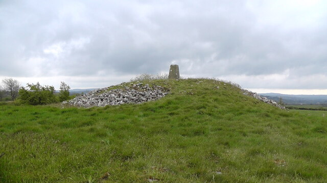
Image: © Sean Davis Taken: 15 May 2021
Vicar's Cairn, the Cairn Road, Carnavanaghan Townland, Co. Armagh. According to http://irishantiquities.bravehost.com/armagh/vicar/vicar.html "This cairn was greatly disturbed in the early 19th century by amateur archaeologists and treasure seekers. In the late 18th century it was reported that a passage or chamber was uncovered and in 1797 it was described as a conical mound of stones surrounded by a kerb. In the next few years there are newspaper reports of the removal of enormous quantities of stone, but that nothing worthy of notice was found. However there are reports of stones with concentric circles and rectangular marks being found. The cairn today is topped by a triangulation pillar but there are no signs of any marked stones, nor any structural stones. However the site is important because it is one of the few recognised passage tombs in Co Armagh."
Images are licensed for reuse under creativecommons.org/licenses/by-sa/2.0
Image Location
Latitude
54.298231
Longitude
-6.596967