Westbury buildings [44]
Introduction
The photograph on this page of Westbury buildings [44] by Michael Dibb as part of the Geograph project.
The Geograph project started in 2005 with the aim of publishing, organising and preserving representative images for every square kilometre of Great Britain, Ireland and the Isle of Man.

There are currently over 7.5m images from over 14,400 individuals and you can help contribute to the project by visiting https://www.geograph.org.uk
Westbury buildings [44]
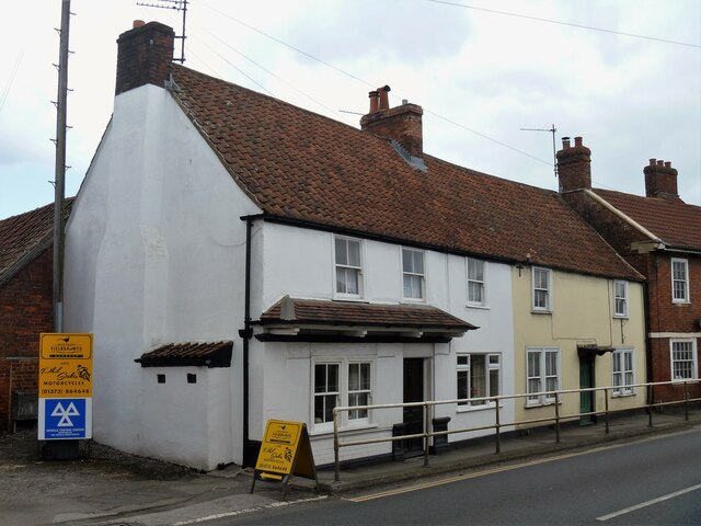
Image: © Michael Dibb Taken: 29 Apr 2021
Numbers 28 and 30 West End are 17th or early 18th century with later alterations. Built of brick, now rendered, with a pantile roof. Number 28 is the former Wheatsheaf public house, number 30 was a butchers shop. Listed, grade II, with details at: https://historicengland.org.uk/listing/the-list/list-entry/1364372 West End suffers from being part of the busy A350 which runs through the town with a constant stream of heavy goods vehicles. Westbury is a former market town in the far west of Wiltshire under the north western edge of Salisbury Plain, 4 miles south of Trowbridge and 4 miles north of Warminster. Westbury was a centre of the cloth industry from the later 15th century until the 19th century. Malting was another important industry. There are now a number of large industrial and trading estates around the town with many residents working there. The town is an important junction point on the railway network with the Reading to Taunton line intersecting the line from Bristol to Southampton.
Images are licensed for reuse under creativecommons.org/licenses/by-sa/2.0
Image Location


Leaflet Map data © OpenStreetMap
Latitude
51.262603
Longitude
-2.183971