Cnwch-coch
Introduction
The photograph on this page of Cnwch-coch by Rudi Winter as part of the Geograph project.
The Geograph project started in 2005 with the aim of publishing, organising and preserving representative images for every square kilometre of Great Britain, Ireland and the Isle of Man.

There are currently over 7.5m images from over 14,400 individuals and you can help contribute to the project by visiting https://www.geograph.org.uk
Cnwch-coch
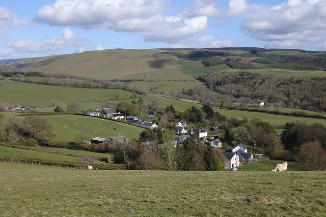
Image: © Rudi Winter Taken: 6 May 2021
The entire village is in view here from the hill above. At the left end of the branch road can be seen Capel Carmel, the Methodist chapel, next to the cemetery. On the left of the picture can be seen Troed-rhiw-rydis farm. The farm in the valley of the Afon Magwr below is Cwmnewidion Isaf.
Images are licensed for reuse under creativecommons.org/licenses/by-sa/2.0
Image Location
Latitude
52.357215
Longitude
-3.944848