Salvation Army citadel, Walter Street, Idle
Introduction
The photograph on this page of Salvation Army citadel, Walter Street, Idle by Stephen Craven as part of the Geograph project.
The Geograph project started in 2005 with the aim of publishing, organising and preserving representative images for every square kilometre of Great Britain, Ireland and the Isle of Man.

There are currently over 7.5m images from over 14,400 individuals and you can help contribute to the project by visiting https://www.geograph.org.uk
Salvation Army citadel, Walter Street, Idle
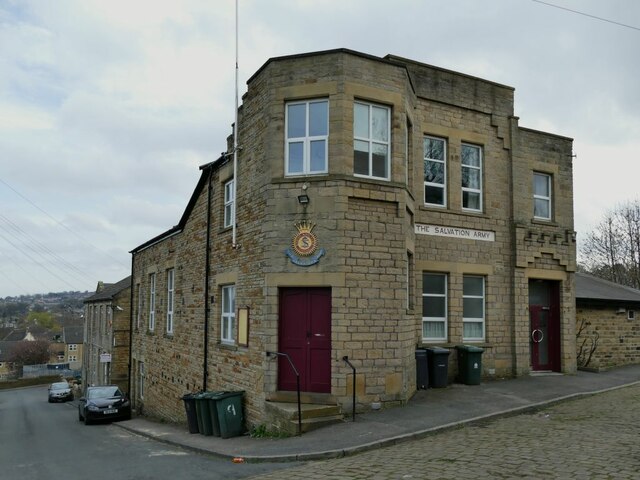
Image: © Stephen Craven Taken: 4 Apr 2021
On an old map it is shown as a "barracks" which is curious because the S.A. is of course not an army in the usual sense, but a religious movement. According to their website, the building was erected in 1890 and Messrs. J Obank were the builders.
Images are licensed for reuse under creativecommons.org/licenses/by-sa/2.0
Image Location
Latitude
53.836157
Longitude
-1.732825