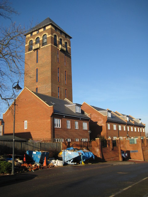
Shenley Tower
Introduction
The photograph on this page of Shenley Tower by Nigel Cox as part of the Geograph project.
The Geograph project started in 2005 with the aim of publishing, organising and preserving representative images for every square kilometre of Great Britain, Ireland and the Isle of Man.
There are currently over 7.5m images from over 14,400 individuals and you can help contribute to the project by visiting https://www.geograph.org.uk

Image: © Nigel Cox Taken: 8 Feb 2008
This landmark Italianate structure was originally built in 1932 as the water tower for the former Shenley Hospital, which closed in the 1990s. As part of the redevelopment of the hospital site for residential purposes the tower has been converted into six duplex apartments, which were completed in 2005. The houses clustered around the base of the tower form part of the gated Blenheim Mews development. The builders' skips are an indication of the recent completion of the construction work. The top of the tower is reputedly about 49 metres, or about 160 feet, above ground level, and is said to offer views across Hertfordshire, London, Essex, Bedfordshire and Buckinghamshire. This view was taken from Laxton Gardens. (From a cartographical and Geograph point of view the tower more or less straddles the 201000 Northing grid line. From the Ordnance Survey 1:10,000 scale mapping, the façade of the tower on the left side of the photograph is in this grid square Image, while the façade on the right side is in Image)

