Disused railway line, Crosskeys
Introduction
The photograph on this page of Disused railway line, Crosskeys by M J Roscoe as part of the Geograph project.
The Geograph project started in 2005 with the aim of publishing, organising and preserving representative images for every square kilometre of Great Britain, Ireland and the Isle of Man.

There are currently over 7.5m images from over 14,400 individuals and you can help contribute to the project by visiting https://www.geograph.org.uk
Disused railway line, Crosskeys
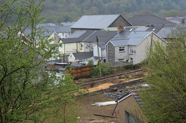
Image: © M J Roscoe Taken: 28 Apr 2021
The chippings indicate that trees and bushes alongside the line have been removed recently. The line was formerly part of the GWR Pennar Branch and finally closed in 1991 following the closure of Oakdale colliery. The original line here was Hall's Tramroad serving his collieries.
Images are licensed for reuse under creativecommons.org/licenses/by-sa/2.0
Image Location
Latitude
51.622134
Longitude
-3.12594