Benchmark, Penrith, Zion Chapel
Introduction
The photograph on this page of Benchmark, Penrith, Zion Chapel by Adrian Taylor as part of the Geograph project.
The Geograph project started in 2005 with the aim of publishing, organising and preserving representative images for every square kilometre of Great Britain, Ireland and the Isle of Man.

There are currently over 7.5m images from over 14,400 individuals and you can help contribute to the project by visiting https://www.geograph.org.uk
Benchmark, Penrith, Zion Chapel
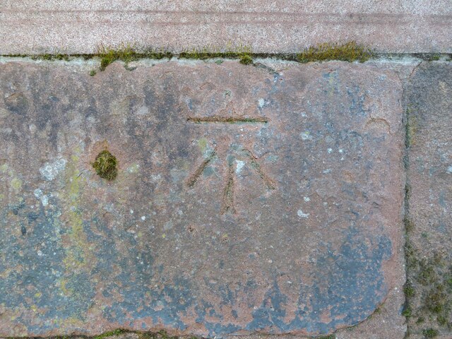
Image: © Adrian Taylor Taken: 9 Apr 2021
Detail of the Ordnance Survey cut benchmark on the sandstone wall in front of the former Zion Chapel, now converted into apartments. The benchmark marks a height of 133.0208m above sea level (Ordnance Datum Newlyn) last verified and levelled in 1972 (location photograph Image).
Images are licensed for reuse under creativecommons.org/licenses/by-sa/2.0
Image Location
Latitude
54.665635
Longitude
-2.749727