Browlands Standing Stones
Introduction
The photograph on this page of Browlands Standing Stones by Anne Burgess as part of the Geograph project.
The Geograph project started in 2005 with the aim of publishing, organising and preserving representative images for every square kilometre of Great Britain, Ireland and the Isle of Man.

There are currently over 7.5m images from over 14,400 individuals and you can help contribute to the project by visiting https://www.geograph.org.uk
Browlands Standing Stones
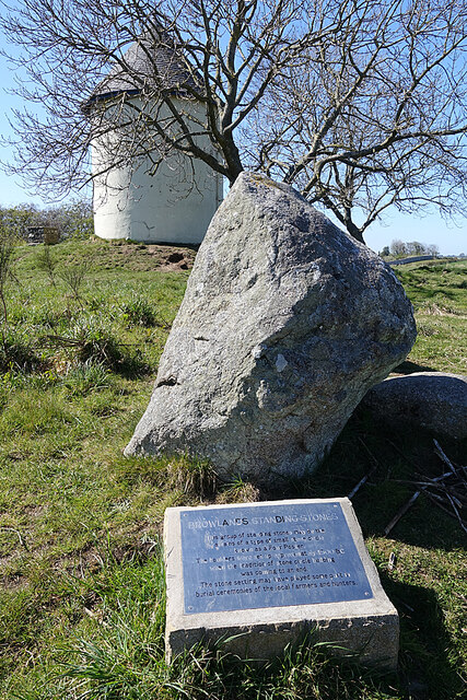
Image: © Anne Burgess Taken: 24 Apr 2021
The standing stones are thought by some to be the remains of a 'four-poster' type Neolithic stone circle, but Historic Environment Scotland isn't so sure. See https://canmore.org.uk/site/16949/browlands-garmouth for more details. Behind them is the Garmouth Water Tower, built at the end of the 19th century but no longer in use.
Images are licensed for reuse under creativecommons.org/licenses/by-sa/2.0
Image Location


Leaflet Map data © OpenStreetMap
Latitude
57.667304
Longitude
-3.109671