75 High Street, Newport
Introduction
The photograph on this page of 75 High Street, Newport by Richard Law as part of the Geograph project.
The Geograph project started in 2005 with the aim of publishing, organising and preserving representative images for every square kilometre of Great Britain, Ireland and the Isle of Man.

There are currently over 7.5m images from over 14,400 individuals and you can help contribute to the project by visiting https://www.geograph.org.uk
75 High Street, Newport
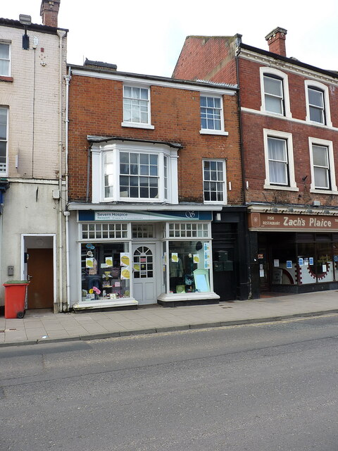
Image: © Richard Law Taken: 29 Mar 2021
Not much of great interest to look at from the front, but the rear of this building is much more spectacular. The core of the house dates from the early 16th century, and was re-faced in brick in the 19th, which completely hides the timber framed structure. Parts of the rear include some rare surviving 10- and 6-light windows, and diamond framing of the timbers. The whole was Grade II listed https://britishlistedbuildings.co.uk/101054396-front-block-and-rear-range-newport#.YI5pqbVKjIU & https://historicengland.org.uk/listing/the-list/list-entry/1054396 in 1978.
Images are licensed for reuse under creativecommons.org/licenses/by-sa/2.0
Image Location


Leaflet Map data © OpenStreetMap
Latitude
52.769077
Longitude
-2.379209