Westbury houses [28]
Introduction
The photograph on this page of Westbury houses [28] by Michael Dibb as part of the Geograph project.
The Geograph project started in 2005 with the aim of publishing, organising and preserving representative images for every square kilometre of Great Britain, Ireland and the Isle of Man.

There are currently over 7.5m images from over 14,400 individuals and you can help contribute to the project by visiting https://www.geograph.org.uk
Westbury houses [28]
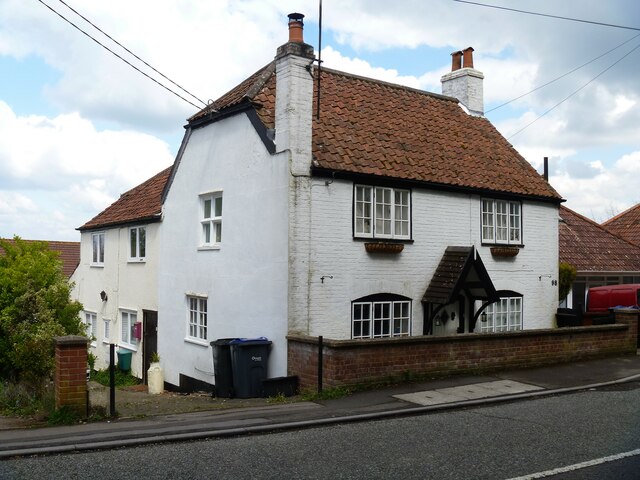
Image: © Michael Dibb Taken: 29 Apr 2021
Numbers 98 and 100 Leigh Road occupy an 'L' plan building built in the early 19th century. Constructed of brick with a pantiled roof. A 17th or early 18th century mullion and transom cross window has been inserted into the left return of number 98. Number 100 is a rear extension. Listed, grade II, with details at: https://historicengland.org.uk/listing/the-list/list-entry/1036297 Westbury is a former market town in the far west of Wiltshire under the north western edge of Salisbury Plain, 4 miles south of Trowbridge and 4 miles north of Warminster. Westbury was a centre of the cloth industry from the later 15th century until the 19th century. Malting was another important industry. There are now a number of large industrial and trading estates around the town with many residents working there. The town is an important junction point on the railway network with the Reading to Taunton line intersecting the line from Bristol to Southampton.
Images are licensed for reuse under creativecommons.org/licenses/by-sa/2.0
Image Location
Latitude
51.253866
Longitude
-2.19325