Bungay former watermill
Introduction
The photograph on this page of Bungay former watermill by Adrian S Pye as part of the Geograph project.
The Geograph project started in 2005 with the aim of publishing, organising and preserving representative images for every square kilometre of Great Britain, Ireland and the Isle of Man.

There are currently over 7.5m images from over 14,400 individuals and you can help contribute to the project by visiting https://www.geograph.org.uk
Bungay former watermill
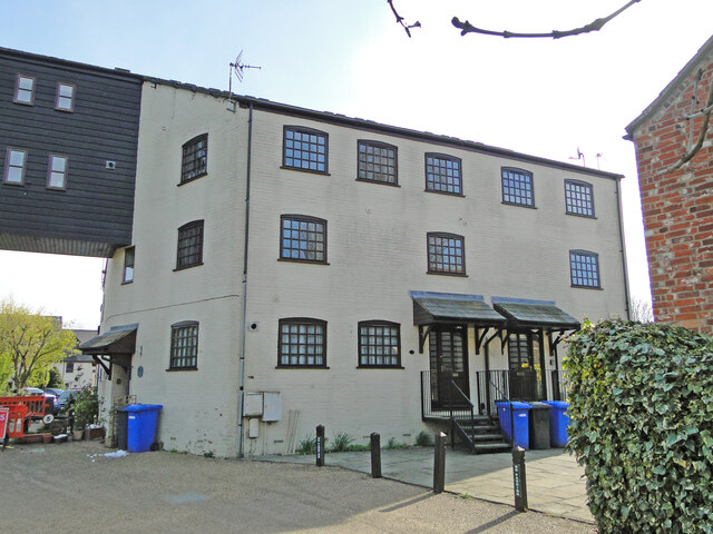
Image: © Adrian S Pye Taken: 28 Apr 2021
Formerly known as Bardolph's Mill, a succession of mills have been built on this site; this building is of Victorian origin. Bungay is the head of navigation for the River Waveney. When the previous mill was working as a paper mill, it burnt down and the site was then bought by later miller Charles Marston's father, who rebuilt it in the 1870s. He fitted a roller plant in the 1890s, before the mill again caught fire and burned down again about 1900. The Marstons then took over Earsham mill for flour production and rebuilt Bungay mill as a provender mill in 1902. The new mill was constructed of weatherboard and brick with a corrugated iron roof. It is unusual because of the extended lucum which extended over the dock for loading the barges. In the 1960s the watercourse adjacent to the mill building was filled in and grassed over and converted into a timber store. In 2003 it became a consultancy and training centre and has since been converted into residential accommodation.
Images are licensed for reuse under creativecommons.org/licenses/by-sa/2.0
Image Location
Latitude
52.455201
Longitude
1.443756