An angular unconformity
Introduction
The photograph on this page of An angular unconformity by Neil Owen as part of the Geograph project.
The Geograph project started in 2005 with the aim of publishing, organising and preserving representative images for every square kilometre of Great Britain, Ireland and the Isle of Man.

There are currently over 7.5m images from over 14,400 individuals and you can help contribute to the project by visiting https://www.geograph.org.uk
An angular unconformity
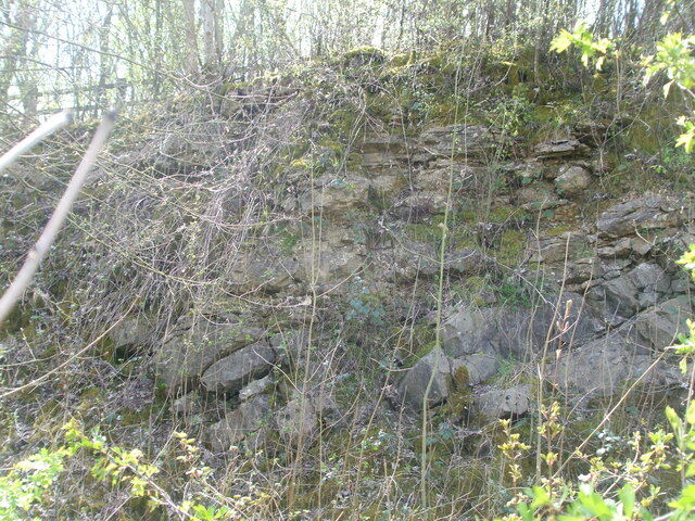
Image: © Neil Owen Taken: 15 Apr 2021
Whilst walking around the area near some large quarries, it was nevertheless a bit of a surprise to come across an information board in an otherwise anonymous stretch of road close to the motorway. It describes the geology at this spot, part of the motorway excavations, and the exposed rockface tells a particular story. Two different layers can be seen in amongst the vegetation: the lower is Carboniferous Limestone, created some 350 million years ago when this spot was equatorial and in a shallow sea. About 280 million years ago the bed of limestone was shifted up and angled as we see today by earth movements. Above this layer is another, namely Dolomitic Conglomerate, which was formed some 220-240 million years ago and sits on top of the limestone. Climate change as well as geographical repositioning brought about erosion of the conglomerate, which has rather smoothed over the surface. The point to note is that the two layers are separated by barely any physical distance, but are 50 million years apart. This is called an angular unconformity, and is one of the highlighted examples in Britain.
Images are licensed for reuse under creativecommons.org/licenses/by-sa/2.0
Image Location
Latitude
51.586191
Longitude
-2.499349