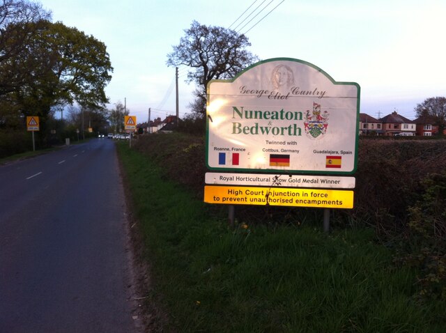
Smorrall Lane at western approach to Bedworth
Introduction
The photograph on this page of Smorrall Lane at western approach to Bedworth by A J Paxton as part of the Geograph project.
The Geograph project started in 2005 with the aim of publishing, organising and preserving representative images for every square kilometre of Great Britain, Ireland and the Isle of Man.
There are currently over 7.5m images from over 14,400 individuals and you can help contribute to the project by visiting https://www.geograph.org.uk

Image: © A J Paxton Taken: 26 Apr 2021
The setting sun is catching the borough council sign with its expressions of local identity through George Eliot associations, town-twinning arrangements with towns in France, Germany and Spain, a horticultural gold medal - oh, and that High Court injunction! Hospital Lane branches off to the south, its ribbon development of 1920s-30s suburban houses visible to the right of the signboard. The town centre of Bedworth is almost directly ahead, about 3km to the east.

