Direction Sign ? Signpost on the A6089 at Nenthorn
Introduction
The photograph on this page of Direction Sign ? Signpost on the A6089 at Nenthorn by I Davison as part of the Geograph project.
The Geograph project started in 2005 with the aim of publishing, organising and preserving representative images for every square kilometre of Great Britain, Ireland and the Isle of Man.

There are currently over 7.5m images from over 14,400 individuals and you can help contribute to the project by visiting https://www.geograph.org.uk
Direction Sign ? Signpost on the A6089 at Nenthorn
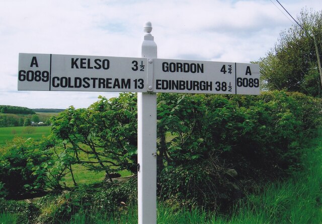
Image: © I Davison Taken: Unknown
Located on the south side of the junction on the A6089 with an unclassified road to Nenthorn House and Girrick. 2 arms and acorn finial. See also https://www.geograph.org.uk/photo/3411363 and https://www.geograph.org.uk/photo/6048878. Milestone Society National ID: BW_NT6837
Images are licensed for reuse under creativecommons.org/licenses/by-sa/2.0
Image Location


Leaflet Map data © OpenStreetMap
Latitude
55.628639
Longitude
-2.508533