Rivet Benchmark
Introduction
The photograph on this page of Rivet Benchmark by Anthony Rowley as part of the Geograph project.
The Geograph project started in 2005 with the aim of publishing, organising and preserving representative images for every square kilometre of Great Britain, Ireland and the Isle of Man.

There are currently over 7.5m images from over 14,400 individuals and you can help contribute to the project by visiting https://www.geograph.org.uk
Rivet Benchmark
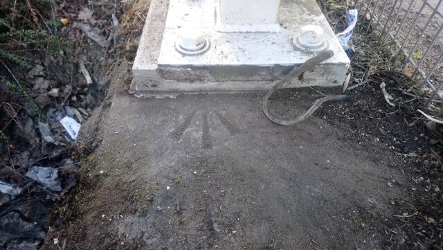
Image: © Anthony Rowley Taken: 22 Apr 2021
A Rivet Benchmark cut into the surface above an underpass. The Rivet has been lost under the support for a barrier. Only the Crow's Foot is now visible
Images are licensed for reuse under creativecommons.org/licenses/by-sa/2.0
Image Location
Latitude
52.689093
Longitude
-2.447191