Hilperton houses [9]
Introduction
The photograph on this page of Hilperton houses [9] by Michael Dibb as part of the Geograph project.
The Geograph project started in 2005 with the aim of publishing, organising and preserving representative images for every square kilometre of Great Britain, Ireland and the Isle of Man.

There are currently over 7.5m images from over 14,400 individuals and you can help contribute to the project by visiting https://www.geograph.org.uk
Hilperton houses [9]
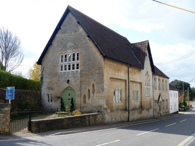
Image: © Michael Dibb Taken: 11 Apr 2021
The former Wesleyan Methodist Church and schoolroom in Church Street has been converted into two dwellings. Constructed in ashlar with a pantiled roof in 1891, replacing an earlier chapel on the same site. Hilperton is a residential village adjacent to the northern suburbs of Trowbridge and is only some 1¼ miles north of Trowbridge town centre. Although the village was recorded in the Domesday Book of 1086, little is known of its history until the 19th century when home-based cloth weaving was a major source of employment. The village was astride the A361 road but is now by-passed.
Images are licensed for reuse under creativecommons.org/licenses/by-sa/2.0
Image Location
Latitude
51.333099
Longitude
-2.183966