Former Lock up, Prees
Introduction
The photograph on this page of Former Lock up, Prees by Brian Deegan as part of the Geograph project.
The Geograph project started in 2005 with the aim of publishing, organising and preserving representative images for every square kilometre of Great Britain, Ireland and the Isle of Man.

There are currently over 7.5m images from over 14,400 individuals and you can help contribute to the project by visiting https://www.geograph.org.uk
Former Lock up, Prees
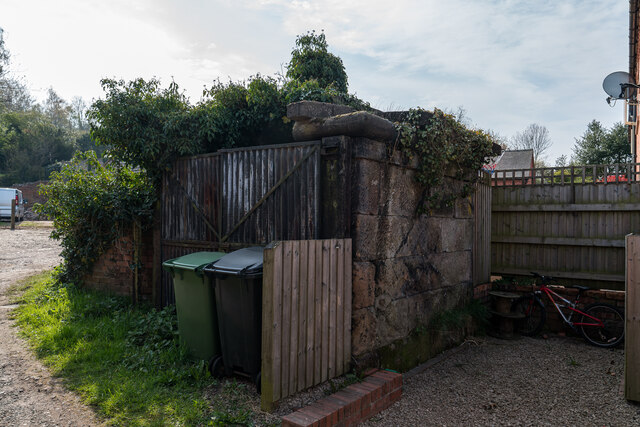
Image: © Brian Deegan Taken: 18 Apr 2021
The former lock-up has a square plan, it is in sandstone, and the roof consists of a flat slab with a moulded cornice and a central ball terminal. On the north side are double doors in corrugated iron. Late 18th century https://historicengland.org.uk/listing/the-list/list-entry/1236333
Images are licensed for reuse under creativecommons.org/licenses/by-sa/2.0
Image Location
Latitude
52.897079
Longitude
-2.665025