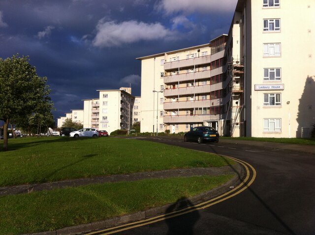
Tower Blocks, Shirestone Road
Introduction
The photograph on this page of Tower Blocks, Shirestone Road by A J Paxton as part of the Geograph project.
The Geograph project started in 2005 with the aim of publishing, organising and preserving representative images for every square kilometre of Great Britain, Ireland and the Isle of Man.
There are currently over 7.5m images from over 14,400 individuals and you can help contribute to the project by visiting https://www.geograph.org.uk

Image: © A J Paxton Taken: 8 May 2014
These six Y-shaped housing blocks were built in 1951, a time of acute housing shortage, for Birmingham County Borough Council (according to Lynsey Hanley in 'Estates', they were the first high-rise council housing in Birmingham). Each block is of 6 storeys with 30 dwellings, so, 180 homes in total. They were built by Wimpey to their 'no-fines' method (concrete made from clinker with no fine aggregates). They were named after Midlands country towns: Banbury, Ledbury, Leominster, Monmouth (now in Wales), Redditch and Stafford. Ledbury House can be seen in the foreground. See https://www.towerblock.eca.ed.ac.uk/development/tile-cross

