Old Boundary Marker on the B725 Glencaple Road, Dumfries
Introduction
The photograph on this page of Old Boundary Marker on the B725 Glencaple Road, Dumfries by W MacDonald as part of the Geograph project.
The Geograph project started in 2005 with the aim of publishing, organising and preserving representative images for every square kilometre of Great Britain, Ireland and the Isle of Man.

There are currently over 7.5m images from over 14,400 individuals and you can help contribute to the project by visiting https://www.geograph.org.uk
Old Boundary Marker on the B725 Glencaple Road, Dumfries
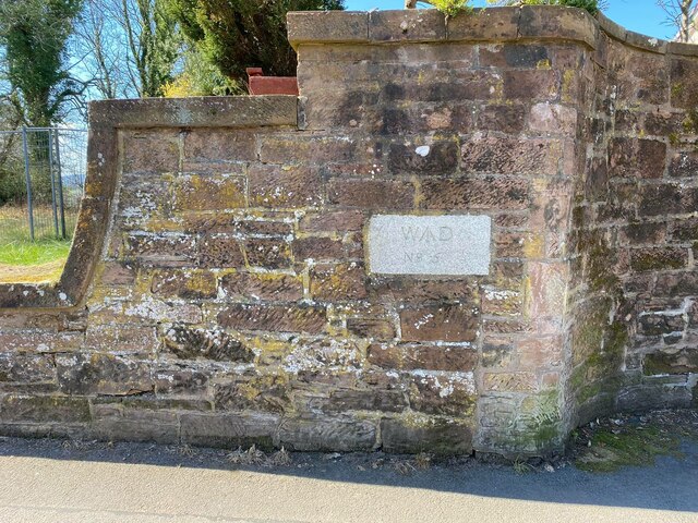
Image: © W MacDonald Taken: 18 Apr 2021
War Department Boundary Marker set in the outer boundary wall of Hannahfield House on the west side of the B725 Glencaple Road, Dumfries, south of its junction with Glencaple Avenue. Inscribed W ↑ D / No. 5. The history of Hannahfield House can be read here https://www.buildingsatrisk.org.uk/details/909982. Category B Listed details http://portal.historicenvironment.scot/designation/LB3829. Milestone Society National ID: DF_WDKING05em
Images are licensed for reuse under creativecommons.org/licenses/by-sa/2.0
Image Location
Latitude
55.05489
Longitude
-3.600591