
St Andrew's Well
Introduction
The photograph on this page of St Andrew's Well by Tiger as part of the Geograph project.
The Geograph project started in 2005 with the aim of publishing, organising and preserving representative images for every square kilometre of Great Britain, Ireland and the Isle of Man.

There are currently over 7.5m images from over 14,400 individuals and you can help contribute to the project by visiting https://www.geograph.org.uk
St Andrew's Well
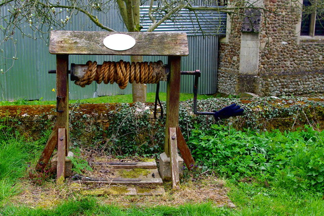
Image: © Tiger Taken: 16 Apr 2021
According to the plaque on the windlass cover this well, immediately north of Image, "was almost certainly sunk to supply water to the Image opposite when they were built by the Revd Edward Powell in 1845. It is known to have continued in use for at least 100 years until mains water, introduced in 1947, was extended to this part of the village." It was restored to mark the Millennium in 2000, with support from the local Parish and District Councils. For the location, just outside the churchyard wall, see John Sutton's view of Image
Images are licensed for reuse under creativecommons.org/licenses/by-sa/2.0
Image Location

Latitude
52.18354
Longitude
-0.008673