Kings Bank Tumulus, Maer
Introduction
The photograph on this page of Kings Bank Tumulus, Maer by Brian Deegan as part of the Geograph project.
The Geograph project started in 2005 with the aim of publishing, organising and preserving representative images for every square kilometre of Great Britain, Ireland and the Isle of Man.

There are currently over 7.5m images from over 14,400 individuals and you can help contribute to the project by visiting https://www.geograph.org.uk
Kings Bank Tumulus, Maer
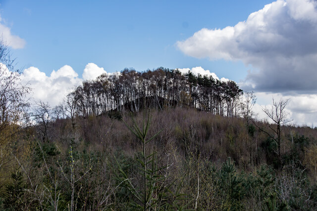
Image: © Brian Deegan Taken: 11 Apr 2021
The remains of a possible burial mound, widely regarded as being a natural feature, although this has not been proven. Allegedly a barrow, but excavated circa 1810 and no finds were made. A mound of circular form, Diameter 130 ft, height 20 ft. King's Bank has a barrow on its apex. A large bowl barrow, hollow in the centre, surmounting a very prominent knoll. A natural conical shaped hill rising quite sharply from the surrounding area. There is only a slight break of slope on top, but not enough to conclusively suggest a tumulus. An amorphous mound situated on a hilltop and with no distinct edges. A pit probably indicates the site of an excavation in 1810. The site may well be natural, but the possibility of it being a barrow cannot be totally ruled out.
Images are licensed for reuse under creativecommons.org/licenses/by-sa/2.0
Image Location
Latitude
52.952877
Longitude
-2.326816