East Webburn valley from Dunstone Down
Introduction
The photograph on this page of East Webburn valley from Dunstone Down by Derek Harper as part of the Geograph project.
The Geograph project started in 2005 with the aim of publishing, organising and preserving representative images for every square kilometre of Great Britain, Ireland and the Isle of Man.

There are currently over 7.5m images from over 14,400 individuals and you can help contribute to the project by visiting https://www.geograph.org.uk
East Webburn valley from Dunstone Down
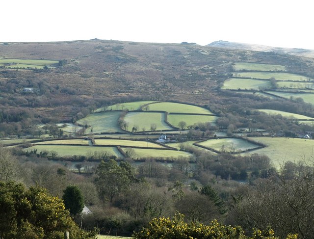
Image: © Derek Harper Taken: 2 Feb 2008
Looking down from the edge of the open moor on Dunstone Down. The river is hidden in the bottom half of the photo. The buildings (Little Meadow in the centre, and Venton on the extreme right) are in Image, on the lane between Widecombe and Chittleford. Beyond the distinctive semi-circle of fields, moorland rises towards Top Tor and Pil Tor, with Rippon Tor just appearing above the horizon.
Images are licensed for reuse under creativecommons.org/licenses/by-sa/2.0
Image Location


Leaflet Map data © OpenStreetMap
Latitude
50.57146
Longitude
-3.810329