
Blocked/diverted footpath at Kemberton Mill Cottage
Introduction
The photograph on this page of Blocked/diverted footpath at Kemberton Mill Cottage by Richard Law as part of the Geograph project.
The Geograph project started in 2005 with the aim of publishing, organising and preserving representative images for every square kilometre of Great Britain, Ireland and the Isle of Man.

There are currently over 7.5m images from over 14,400 individuals and you can help contribute to the project by visiting https://www.geograph.org.uk
Blocked/diverted footpath at Kemberton Mill Cottage
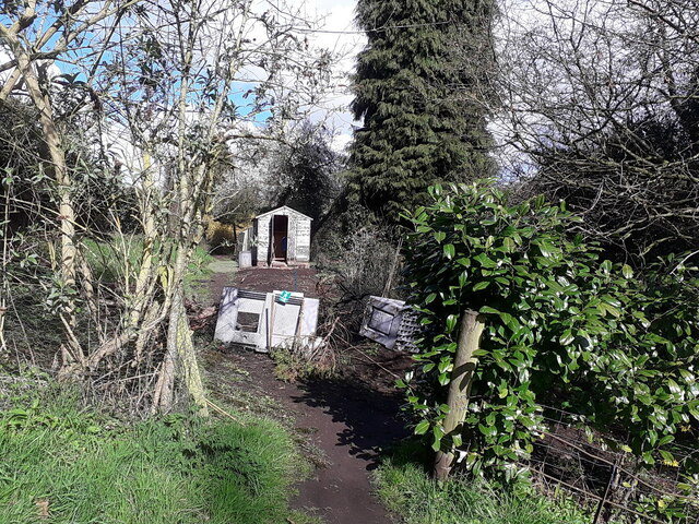
Image: © Richard Law Taken: 11 Apr 2021
The right of way here runs, for 20 or 30 yards, through the garden of Kemberton Mill Cottage, alongside the shed that's visible in the background. During the 2020 and 2021 COVID-19 pandemic, the owners of the property have made a temporary agreement with the Shropshire Council Rights of Way team to divert the path around their boundary, in order to reduce contact between walkers and family members, one of whom is classed as 'vulnerable'. It is expected that the path will be reinstated once the worst of the pandemic is over.
Images are licensed for reuse under creativecommons.org/licenses/by-sa/2.0
Image Location

Latitude
52.636288
Longitude
-2.379862