Briston village sign
Introduction
The photograph on this page of Briston village sign by Adrian S Pye as part of the Geograph project.
The Geograph project started in 2005 with the aim of publishing, organising and preserving representative images for every square kilometre of Great Britain, Ireland and the Isle of Man.

There are currently over 7.5m images from over 14,400 individuals and you can help contribute to the project by visiting https://www.geograph.org.uk
Briston village sign
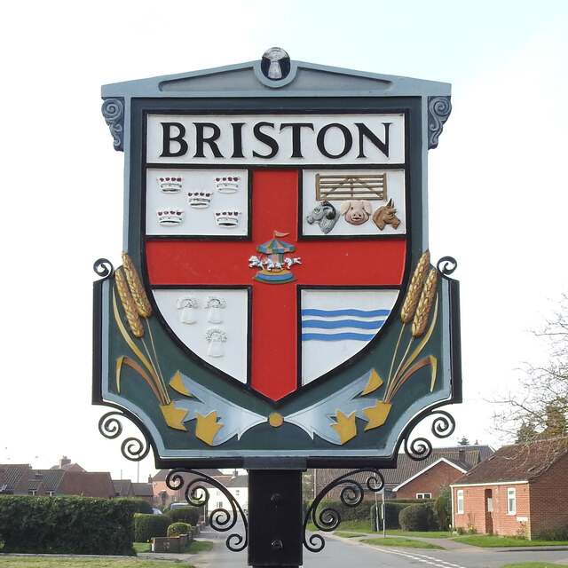
Image: © Adrian S Pye Taken: 31 Mar 2021
The sign is double sided and identical on both. It is surmounted by a tiny wheatsheaf, and divided into four grounds by a red cross. Top right are five crowns for a reason I have yet to establish. The five bar gate and farm animals and the wheatsheaves below are representing the agricultural heritage of the parish, as are the ears of wheat below the shield. The River Bure, which is represented by the wavy blue lines, bottom right. In the centre is a merry-go-round reminiscent of the fair held on the village green. https://www.geograph.org.uk/photo/6800228
Images are licensed for reuse under creativecommons.org/licenses/by-sa/2.0
Image Location
Latitude
52.853697
Longitude
1.059227