A benchmark on Sandford chapel?
Introduction
The photograph on this page of A benchmark on Sandford chapel? by Neil Owen as part of the Geograph project.
The Geograph project started in 2005 with the aim of publishing, organising and preserving representative images for every square kilometre of Great Britain, Ireland and the Isle of Man.

There are currently over 7.5m images from over 14,400 individuals and you can help contribute to the project by visiting https://www.geograph.org.uk
A benchmark on Sandford chapel?
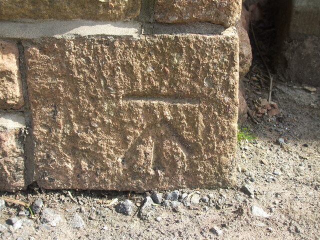
Image: © Neil Owen Taken: 30 Mar 2021
This mark looks very much like an O.S. cutmark, but there appear to be no records of any kind of its existence. Is it a curious coincidence, a replica mark or has the block been reused from another building? See https://www.bench-marks.org.uk/bm140099 for the entry in the Benchmark Database and Image] for a wider view.
Images are licensed for reuse under creativecommons.org/licenses/by-sa/2.0
Image Location


Leaflet Map data © OpenStreetMap
Latitude
51.329734
Longitude
-2.833851