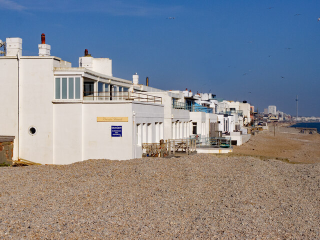
Portslade-by-Sea : beach-front houses, Western Esplanade
Introduction
The photograph on this page of Portslade-by-Sea : beach-front houses, Western Esplanade by Jim Osley as part of the Geograph project.
The Geograph project started in 2005 with the aim of publishing, organising and preserving representative images for every square kilometre of Great Britain, Ireland and the Isle of Man.
There are currently over 7.5m images from over 14,400 individuals and you can help contribute to the project by visiting https://www.geograph.org.uk

Image: © Jim Osley Taken: 5 Apr 2021
Exclusive development (ca.1909) of beach front houses. "An unusual seafront development, known as Hove Seaside Villas, is noted for its celebrity residents. It lies on the esplanade with a private beach and provides a striking rendered and castellated silhouette from Hove Lawns and across the port." - https://ww3.brighton-hove.gov.uk/sites/brighton-hove.gov.uk/files/downloads/conservation/UrbanStdy_West_Hove_final.pdf. "Judy Middleton in her "Encyclopaedia of Hove & Portslade" provides a fascinating history of this unusual development. The villas were designed by architect E J Holland for developer Michael Paget Baxter (MPB). From 1908 onwards piles were sunk 20 feet into the foreshore to support a huge concrete platform on which the villas were erected using 12" thick concrete blocks and railway sleepers. MPB and his wife lived in no.1 at the eastern end, the first one to be built. Originally it had tennis courts and a rose garden. They stayed put, even during WW2, when the villas were requisitioned by the Royal Canadian Airforce and an ack-ack gun was installed on the roof." - http://brightonbits.blogspot.com/2011/07/hove-seaside-villas-2.html.

