Shuen Strip
Introduction
The photograph on this page of Shuen Strip by Anne Burgess as part of the Geograph project.
The Geograph project started in 2005 with the aim of publishing, organising and preserving representative images for every square kilometre of Great Britain, Ireland and the Isle of Man.

There are currently over 7.5m images from over 14,400 individuals and you can help contribute to the project by visiting https://www.geograph.org.uk
Shuen Strip
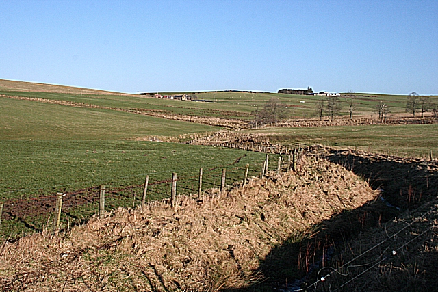
Image: © Anne Burgess Taken: 6 Feb 2008
A stripe is a burn or small watercourse, but I am unsure of the origin of the peculiar-looking name Shuen; it could perhaps be from Gaelic 'seann' meaning 'old'. It looks as if it has been artificially deepened to improve the drainage. The farms on the skyline are Upper Hillside on the left and Carbrotach on the right.
Images are licensed for reuse under creativecommons.org/licenses/by-sa/2.0
Image Location


Leaflet Map data © OpenStreetMap
Latitude
57.470834
Longitude
-2.969154