Old iron post on a public bridleway
Introduction
The photograph on this page of Old iron post on a public bridleway by Stephen Craven as part of the Geograph project.
The Geograph project started in 2005 with the aim of publishing, organising and preserving representative images for every square kilometre of Great Britain, Ireland and the Isle of Man.

There are currently over 7.5m images from over 14,400 individuals and you can help contribute to the project by visiting https://www.geograph.org.uk
Old iron post on a public bridleway
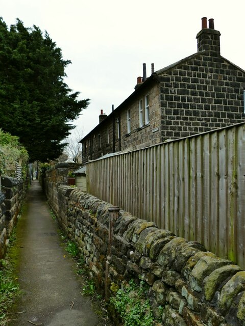
Image: © Stephen Craven Taken: 28 Mar 2021
This post set into the stone wall looks as if it may have been the base of a (gas?) streetlamp originally. The houses to the right are called Joffre Mount and are reached from Rufford Close on the other side.
Images are licensed for reuse under creativecommons.org/licenses/by-sa/2.0
Image Location
Latitude
53.863801
Longitude
-1.680189