Wickhambrook village sign (north face)
Introduction
The photograph on this page of Wickhambrook village sign (north face) by Adrian S Pye as part of the Geograph project.
The Geograph project started in 2005 with the aim of publishing, organising and preserving representative images for every square kilometre of Great Britain, Ireland and the Isle of Man.

There are currently over 7.5m images from over 14,400 individuals and you can help contribute to the project by visiting https://www.geograph.org.uk
Wickhambrook village sign (north face)
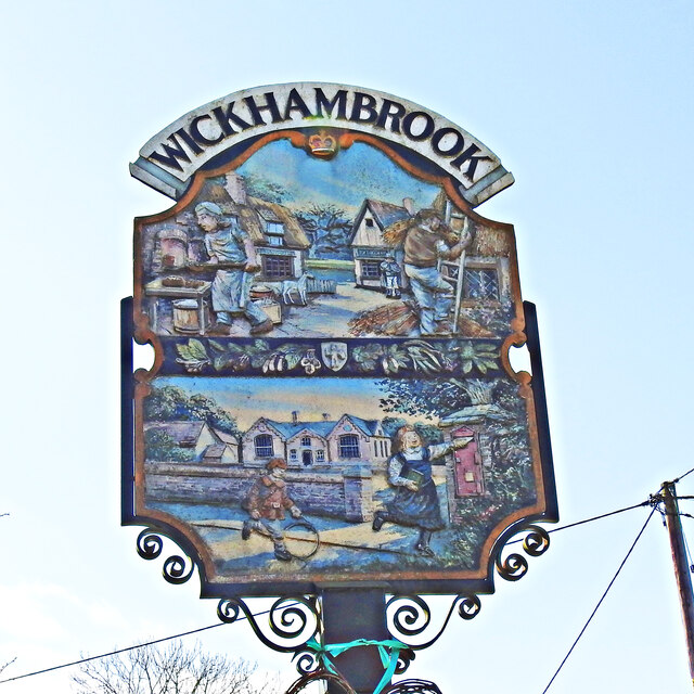
Image: © Adrian S Pye Taken: 29 Mar 2021
On this side the crown at the top represents the visit of Princess Anne to the village in 1979. The upper panel shows two of the village crafts, bakery and thatching, and the two pubs, The Greyhound and The Cloak, in the background, the latter having closed in 1989 The tree between them represents the orchards of Justin Brooke of Clopton Hall. The lower panel depicts the Victorian school with the children playing. The post box, dating from 1859 and the only one of its kind in the British Isles. The south face can be seen here https://www.geograph.org.uk/photo/6790517 https://www.geograph.org.uk/photo/4295586 Thanks to Peter Miller and Wickhambrook website
Images are licensed for reuse under creativecommons.org/licenses/by-sa/2.0
Image Location
Latitude
52.168319
Longitude
0.549365