Steventon Road, W12
Introduction
The photograph on this page of Steventon Road, W12 by Phillip Perry as part of the Geograph project.
The Geograph project started in 2005 with the aim of publishing, organising and preserving representative images for every square kilometre of Great Britain, Ireland and the Isle of Man.

There are currently over 7.5m images from over 14,400 individuals and you can help contribute to the project by visiting https://www.geograph.org.uk
Steventon Road, W12
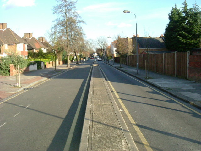
Image: © Phillip Perry Taken: 1 Feb 2008
A rather unusual way of dividing a road, it's not a dual carriageway as we would know it and you can only drive down the right hand lane as you look at it. It's only one way going away from the picture, yet on the left side is access to a few houses. This has to be about 100 yards/metres long. Also see:Image
Images are licensed for reuse under creativecommons.org/licenses/by-sa/2.0
Image Location


Leaflet Map data © OpenStreetMap
Latitude
51.510667
Longitude
-0.246108