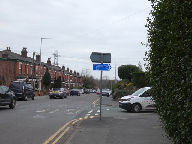
Junction of Stockport Road and Elm Field Road
Introduction
The photograph on this page of Junction of Stockport Road and Elm Field Road by Gerald England as part of the Geograph project.
The Geograph project started in 2005 with the aim of publishing, organising and preserving representative images for every square kilometre of Great Britain, Ireland and the Isle of Man.
There are currently over 7.5m images from over 14,400 individuals and you can help contribute to the project by visiting https://www.geograph.org.uk

Image: © Gerald England Taken: 23 Mar 2021
The blue sign for the National Cycle Network route 55 points up Elm Field Road. I thought this was a new sign although I was puzzled by it as Marple and Macclesfield are actually in the opposite direction. Research using Google Streetview reveals that the sign was erected between April 2011 and August 2012 and then pointed towards Bredbury Hall. At some time between July 2019 and October 2020 the sign was turned round and now points in the wrong direction. NCN route 55 runs from Ironbridge to Preston https://www.sustrans.org.uk/find-a-route-on-the-national-cycle-network/route-55

