
Old School Playing Fields Notice
Introduction
The photograph on this page of Old School Playing Fields Notice by Ian Dodds as part of the Geograph project.
The Geograph project started in 2005 with the aim of publishing, organising and preserving representative images for every square kilometre of Great Britain, Ireland and the Isle of Man.

There are currently over 7.5m images from over 14,400 individuals and you can help contribute to the project by visiting https://www.geograph.org.uk
Old School Playing Fields Notice
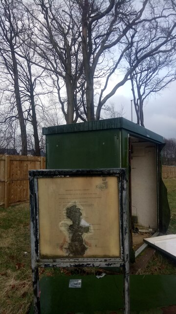
Image: © Ian Dodds Taken: 25 Mar 2021
The remarkably thing about this notice isn't that it escaped the demolition work when the original West Calder High School was pulled down a year or two ago, but that it was still there when it got pulled down. I'd guess it was erected when the original school was built in 1965. It definitely dates from before 1975 though, as that year council boundaries were redrawn all over Scotland - as can just about be seen from the blurry text this used to be Midlothian. In fact East, West and Mid Calder were all originally part of Midlothian. It is interesting to note, from looking at the second rule on the list, that it was a given that it would be a headmaster rather than a headmistress in charge!
Images are licensed for reuse under creativecommons.org/licenses/by-sa/2.0
Image Location

Latitude
55.862208
Longitude
-3.541789