Old Boundary Marker
Introduction
The photograph on this page of Old Boundary Marker by R Westcott as part of the Geograph project.
The Geograph project started in 2005 with the aim of publishing, organising and preserving representative images for every square kilometre of Great Britain, Ireland and the Isle of Man.

There are currently over 7.5m images from over 14,400 individuals and you can help contribute to the project by visiting https://www.geograph.org.uk
Old Boundary Marker
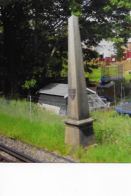
Image: © R Westcott Taken: Unknown
Coal Tax Marker beside the railway 400 metres south of Whyteleafe station but visible from the west. For the history of these markers read http://www.coaldutyposts.org.uk/cityposts.html. This is Martin Nail’s No. 170. Grade II Listed details https://historicengland.org.uk/listing/the-list/list-entry/1029795. Milestone Society National ID: SY_CTWHY04bm
Images are licensed for reuse under creativecommons.org/licenses/by-sa/2.0
Image Location
Latitude
51.306525
Longitude
-0.079713