Cattle creep under the former Waverley Line
Introduction
The photograph on this page of Cattle creep under the former Waverley Line by James T M Towill as part of the Geograph project.
The Geograph project started in 2005 with the aim of publishing, organising and preserving representative images for every square kilometre of Great Britain, Ireland and the Isle of Man.

There are currently over 7.5m images from over 14,400 individuals and you can help contribute to the project by visiting https://www.geograph.org.uk
Cattle creep under the former Waverley Line
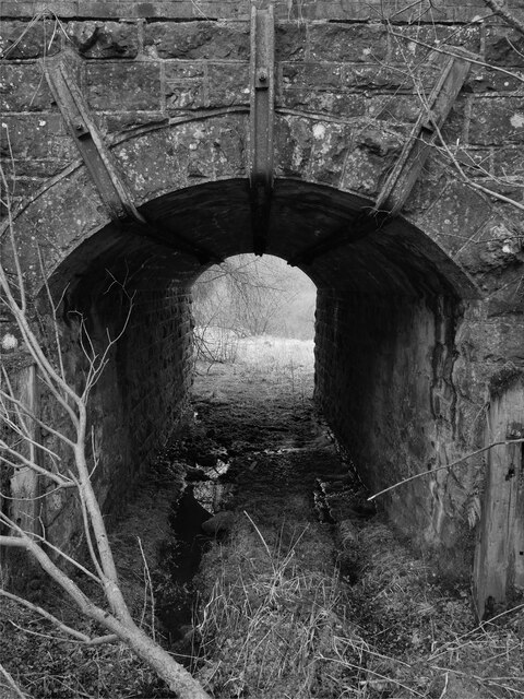
Image: © James T M Towill Taken: 20 Mar 2021
A rather boggy cattle creep under the former Waverley Line between Kershopefoot and Stonegarthside. The middle piece of metalwork bears the stamp Moss Bay Steel - this will relate to Moss Bay Hematite Iron and Steel Company at Workington on the west Cumbrian coast. The company's products were used extensively in Britain and worldwide - such as on the Burma Railway and on American railroads. Moss Bay closed in 2006 - see https://www.timesandstar.co.uk/news/17057236.heartbreak-and-tears-as-rail-making-bids-farewell-to-workington/ As the company was founded in 1871, this reinforcement metalwork must have been installed after the railway had been in use for at least 10 years. This photograph was taken during the Coronavirus (COVID-19) pandemic of 2020/21.
Images are licensed for reuse under creativecommons.org/licenses/by-sa/2.0
Image Location
Latitude
55.122002
Longitude
-2.828503