Benchmark on house on SE side of A595 at Cardewlees
Introduction
The photograph on this page of Benchmark on house on SE side of A595 at Cardewlees by Roger Templeman as part of the Geograph project.
The Geograph project started in 2005 with the aim of publishing, organising and preserving representative images for every square kilometre of Great Britain, Ireland and the Isle of Man.

There are currently over 7.5m images from over 14,400 individuals and you can help contribute to the project by visiting https://www.geograph.org.uk
Benchmark on house on SE side of A595 at Cardewlees
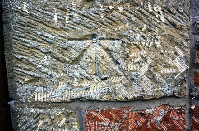
Image: © Roger Templeman Taken: 13 Aug 2019
Ordnance Survey 1GL bolt benchmark a survivor from the 1843/4 Kirkby Kendal to Carlisle survey when it was levelled at 155.225 feet above Liverpool Datum. The surveyor's description was 'No. 368. Bolt in North-east corner of Cardew Lees New Inn ; 4.26 ft. above surface'. There is more information at www.bench-marks.org.uk/bm36198
Images are licensed for reuse under creativecommons.org/licenses/by-sa/2.0
Image Location
Latitude
54.853369
Longitude
-3.020804