Wallingford's Shortest Footpath?
Introduction
The photograph on this page of Wallingford's Shortest Footpath? by Des Blenkinsopp as part of the Geograph project.
The Geograph project started in 2005 with the aim of publishing, organising and preserving representative images for every square kilometre of Great Britain, Ireland and the Isle of Man.

There are currently over 7.5m images from over 14,400 individuals and you can help contribute to the project by visiting https://www.geograph.org.uk
Wallingford's Shortest Footpath?
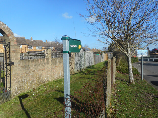
Image: © Des Blenkinsopp Taken: 27 Feb 2021
Shown on the map as following the edge of a school field to Castle Street at the other end, the path is no longer in existence beyond the 20 metres or so visible here, where bushes take over. For a long time there has been a road following the same route a short distance away, and the path is redundant but I guess nobody has gone through the rigmarole of officially closing it. There is even a recent looking signpost at this end, as seen here.
Images are licensed for reuse under creativecommons.org/licenses/by-sa/2.0
Image Location
Latitude
51.60623
Longitude
-1.128505