Portland and Chesil Beach [5]
Introduction
The photograph on this page of Portland and Chesil Beach [5] by Michael Dibb as part of the Geograph project.
The Geograph project started in 2005 with the aim of publishing, organising and preserving representative images for every square kilometre of Great Britain, Ireland and the Isle of Man.

There are currently over 7.5m images from over 14,400 individuals and you can help contribute to the project by visiting https://www.geograph.org.uk
Portland and Chesil Beach [5]
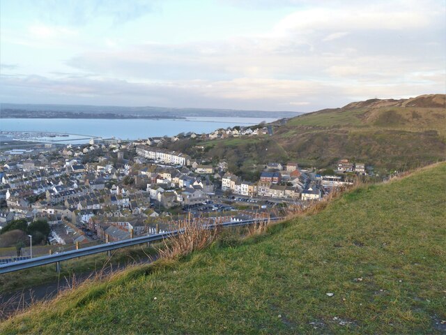
Image: © Michael Dibb Taken: 11 Dec 2020
This view from near the Olympic Rings Image looks over Fortuneswell towards Portland Harbour. The tower of the church of St John is prominent. The Isle of Portland is a tied island, some 5 miles south of the resort of Weymouth, the southernmost point of the county of Dorset, joined to the mainland by Chesil Beach. The Isle has been inhabited since at least the Mesolithic period. Portland stone, a limestone famous for its use in world architecture is quarried here. Portland Harbour, is one of the largest man-made harbours in the world. Chesil Beach, a barrier beach, runs for 18 miles from West Bay to the Isle of Portland and in places is 50 feet high and 650 feet wide.
Images are licensed for reuse under creativecommons.org/licenses/by-sa/2.0
Image Location
Latitude
50.560766
Longitude
-2.443815