East Howe: Merryfield Lane
Introduction
The photograph on this page of East Howe: Merryfield Lane by Chris Downer as part of the Geograph project.
The Geograph project started in 2005 with the aim of publishing, organising and preserving representative images for every square kilometre of Great Britain, Ireland and the Isle of Man.

There are currently over 7.5m images from over 14,400 individuals and you can help contribute to the project by visiting https://www.geograph.org.uk
East Howe: Merryfield Lane
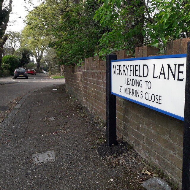
Image: © Chris Downer Taken: 11 Apr 2020
A short dead-end road, but a through route for pedestrians cutting off the corner of Kinson Road and East Howe Lane. From the map or on the ground, it is easy to appreciate that this was an original track which would have cut off the same corner when these were all lanes. It retains the 'laney' feel. The sign is a modern one, dating from around 2014-15, by which time the council had replaced the coloured logo, which had been prone to fading after a while, to simple wording BOURNEMOUTH BOROUGH COUNCIL in smaller type. It also refers to St. Merrin's Close, a short cul-de-sac of council semis. This is photo no.268 of a series of 453 in my coronavirus lockdown walking project: See https://www.geograph.org.uk/article/My-2020-Coronavirus-Lockdown-walking-project for the complete set of photos.
Images are licensed for reuse under creativecommons.org/licenses/by-sa/2.0
Image Location
Latitude
50.759321
Longitude
-1.899713