Drumgirnan floods 1979
Introduction
The photograph on this page of Drumgirnan floods 1979 by Mary and Angus Hogg as part of the Geograph project.
The Geograph project started in 2005 with the aim of publishing, organising and preserving representative images for every square kilometre of Great Britain, Ireland and the Isle of Man.

There are currently over 7.5m images from over 14,400 individuals and you can help contribute to the project by visiting https://www.geograph.org.uk
Drumgirnan floods 1979
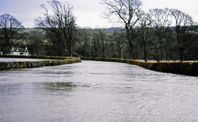
Image: © Mary and Angus Hogg Taken: Unknown
The Water of Girvan spilled well over its flood plain in February 1979. The river's normal course lies beyond the first row of trees in this shot. For a normal view, see Image
Images are licensed for reuse under creativecommons.org/licenses/by-sa/2.0
Image Location


Leaflet Map data © OpenStreetMap
Latitude
55.30271
Longitude
-4.672001