Cretingham village sign (explanation)
Introduction
The photograph on this page of Cretingham village sign (explanation) by Adrian S Pye as part of the Geograph project.
The Geograph project started in 2005 with the aim of publishing, organising and preserving representative images for every square kilometre of Great Britain, Ireland and the Isle of Man.

There are currently over 7.5m images from over 14,400 individuals and you can help contribute to the project by visiting https://www.geograph.org.uk
Cretingham village sign (explanation)
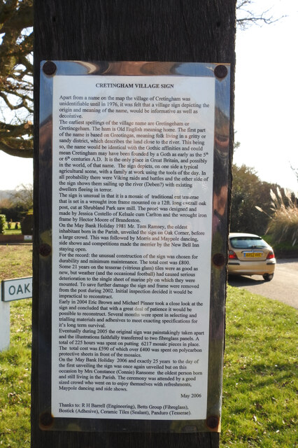
Image: © Adrian S Pye Taken: 9 Mar 2021
The mosaics are not easy to distinguish especially in sunlight but the village has thoughtfully attached this explanation of the sign so the viewer can make sense of the pictures. https://www.geograph.org.uk/photo/4374145 https://www.geograph.org.uk/photo/4374141
Images are licensed for reuse under creativecommons.org/licenses/by-sa/2.0
Image Location
Latitude
52.195985
Longitude
1.259023