Former Vicarage, Front Street, Benton
Introduction
The photograph on this page of Former Vicarage, Front Street, Benton by Geoff Holland as part of the Geograph project.
The Geograph project started in 2005 with the aim of publishing, organising and preserving representative images for every square kilometre of Great Britain, Ireland and the Isle of Man.

There are currently over 7.5m images from over 14,400 individuals and you can help contribute to the project by visiting https://www.geograph.org.uk
Former Vicarage, Front Street, Benton
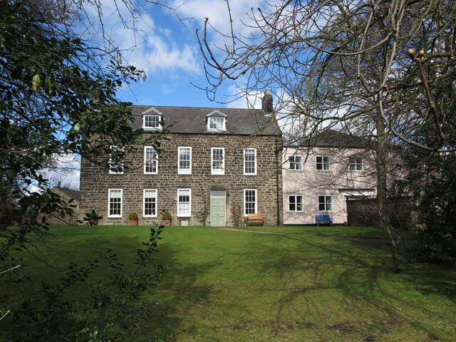
Image: © Geoff Holland Taken: 16 Mar 2021
This stone-built two-storey house with attics was built in about 1734 with the entrance hall and dining room added in about 1757. During its long life, as well as being used as a vicarage, it has been used as an orphanage and a university halls of residence along with the neighbouring North House https://www.geograph.org.uk/photo/6779367). It is a Grade II Listed building. For a selection of detailed free to download walking routes in the area visit www.northtynesidewalks.co.uk
Images are licensed for reuse under creativecommons.org/licenses/by-sa/2.0
Image Location
Latitude
55.010314
Longitude
-1.574663